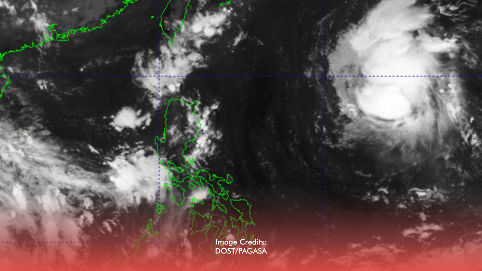
Tropical Storm Queenie—internationally named Surigae—has entered the Philippine Area of Responsibility and is forecast to strengthen further over the weekend, PAGASA said, according to Philstar.
Where It Is Now
As of 4 p.m. Thursday, Sept. 24, Queenie was about 1,225 kilometers east of northern Luzon, packing maximum sustained winds of 75 kph near the center and gusts of up to 90 kph. PAGASA expects it to upgrade into a severe tropical storm by Friday afternoon and to intensify into a typhoon over the weekend.
Rain Outlook
Even while Queenie remains far offshore, PAGASA flagged:
- Cloudy skies with scattered rains and thunderstorms over Mindanao, the Negros Island Region, Aklan, Iloilo, Guimaras, and Siquijor
- Partly cloudy to cloudy with isolated rain showers or thunderstorms over Bicol, the rest of the Visayas, Metro Manila, and the rest of the country
What Residents Should Watch
The center is still more than a thousand kilometers from northern Luzon in that advisory, so it is not an imminent landfall threat there. Still: track PAGASA bulletins for path and signal changes; prepare for possible rough seas along eastern seaboards; treat scattered rains—especially over Mindanao and parts of the Visayas—as a near-term hazard even before Queenie draws closer.